
Augusta ZIP Coverage at a Glance
Augusta Maps shows ten ZIP areas inside or around Richmond County context. Seven use the 309 prefix and three 308-prefix zones touch institutional, separate-city, or western and southern geography. Neighborhood names are practical landmarks, not formal postal borders. USPS address verification and the parcel map are the final checks for any one property.
| ZIP | Areas Covered | Post Office | Notes |
|---|---|---|---|
| 30901 | Downtown, Olde Town, east-central Augusta | Augusta main office, 525 8th St | Historic core and processing link with 30904 |
| 30904 | Summerville, Harrisburg, Sand Hills | Augusta postal area | Neighborhood and ZIP lines do not coincide |
| 30905 | Fort Eisenhower | Military installation | Federal access and address conventions |
| 30906 | South Augusta, Peach Orchard | Peach Orchard station, 3108 Peach Orchard Rd | Broad, varied delivery geography |
| 30907 | West Augusta, Martinez edge | Augusta postal area | County must be checked near Columbia County |
| 30909 | Forest Hills and west-central Augusta | 3301 Wrightsboro Rd | Broad residential and commercial area |
| 30912 | Augusta University medical campus | Institutional delivery | Not an ordinary neighborhood ZIP |
| 30812 | Gracewood | 102 Myrtle Blvd | Institutional and community area |
| 30815 | Hephzibah and southern Richmond County | 4902 Windsor Spring Rd | Hephzibah remains a separate municipality |
| 30805, 30813 | Blythe, Grovetown edge, western region | Regional stations | Do not infer Augusta jurisdiction from mail |
The Augusta ZIP code directory is a starting grid. It cannot replace the official standardized address, parcel county, or municipal line. This matters most in Gracewood, Hephzibah, Blythe, the Martinez edge, and institutional areas. Keep the ZIP code directory beside the map instead of treating either tool as a full resident roll.
Augusta ZIP 30901's Historic Core
ZIP 30901 covers Downtown, Olde Town, and much of east-central Augusta. It contains the historic core, where early city directories and the oldest Sanborn map coverage are strongest. A postal search here can be paired with parcel, historic district, old city-limit, directory, and fire-insurance map evidence.
Do not assume one modern ZIP boundary fits every past record. Early directories sort residents by names and street addresses as printed at the time, while historic maps use the street layout and numbering of their own edition. The main postal office is at 525 8th Street, but station assignment says nothing about the owner or occupant of a parcel.
The Augusta Comprehensive Plan provides current planning context for the core and other areas.
Review Augusta's official planning page before using the plan screen below.

The planning material adds geographic context, but parcel and USPS tools still control an exact address check.
Augusta's Military and Campus ZIPs
Two Augusta ZIP areas behave unlike ordinary neighborhoods. ZIP 30905 serves Fort Eisenhower, formerly Fort Gordon. Military access controls and federal address conventions can limit ordinary parcel or directory methods. ZIP 30912 serves Augusta University's medical campus as a unique institutional ZIP. It is not a general neighborhood roll.
Institutional control changes what an address proves. A campus or military mailing address can identify a delivery point without describing a private residence. Begin with the institution's address format, verify the exact line through USPS, and use only the public records kept by the right custodian. Do not force institutional addresses into a household model.
- ZIP
- A USPS delivery area, not a city or county boundary.
- ZIP+4
- An added four-digit segment that narrows delivery to a route, block, building, or unit group.
- Unique ZIP
- A ZIP assigned to a large institution rather than a normal neighborhood area.
- Carrier route
- A delivery path within a ZIP, useful for mail operations but not a list of residents.
Note: Military and campus ZIPs require address verification, and neither should be treated as a browseable Augusta household directory.
Find Augusta Records by ZIP
A ZIP code narrows geography before a record search, but no verified Augusta assessor form offers a ZIP-wide owner export. USPS can standardize one address or return ZIPs for a city and state. Augusta Maps can display ZIP lines over parcels, neighborhoods, county lines, and municipal boundaries. Those tools work together rather than as one resident list.
- Enter the full street address in the USPS ZIP Code Lookup and record the standardized city and ZIP.
- Open Augusta Maps, find the parcel, and confirm the situs, parcel ID, and Richmond County location.
- Turn on ZIP Codes, Municipal Boundaries, and Richmond County Line. Add one context layer at a time.
- Use the responsible custodian for the next record. A ZIP alone does not choose the clerk, town, or state.
When the search narrows from a delivery area to one road, the Augusta street directory explains the address-level record chain. That handoff prevents the ZIP code directory from making street-level claims it cannot support.
| USPS Mode | Fields | Best Use |
|---|---|---|
| Find by Address | Street address, city, state | Verify one standardized Augusta mailing ZIP |
| Find by City & State | City and state | See ZIPs associated with a place name |
Augusta ZIPs at County Edges
ZIP 30907 reaches West Augusta and Martinez-edge addresses. An address may use Augusta as its preferred city while sitting near or within Columbia County geography. ZIPs 30805 and 30813 appear on the county GIS layer around Blythe, Grovetown-edge, or western regional areas. The last line of mail cannot decide the record custodian.
ZIP 30815 includes Hephzibah and southern Richmond County. Hephzibah remains a separate municipality even though it lies inside Richmond County. Blythe does too. Augusta and Richmond County have operated as a consolidated government since 1996, but that structure does not erase those cities. Check municipal and county layers before sending a permit, code, election, or local records request.
North Augusta creates a second kind of edge. It lies across the Savannah River in Aiken County, South Carolina. An Augusta-area newspaper item or directory entry may describe the broader Augusta-Aiken region without placing the person in Richmond County. Cross-state family and resident trails need South Carolina sources when the address points there.
Augusta ZIP Community Context
ZIP lines overlap Augusta neighborhood, historic district, census, commission, police, fire, and planning geographies. Those layers explain an area but do not identify who lives there. Downtown, Olde Town, Summerville, Harrisburg, Laney Walker, Bethlehem, Forest Hills, and Sandhills each have record histories that may fit inside more than one modern boundary.
The city's service index links residents to public programs and neighborhood information. Open Augusta's municipal services index for the official context shown below.
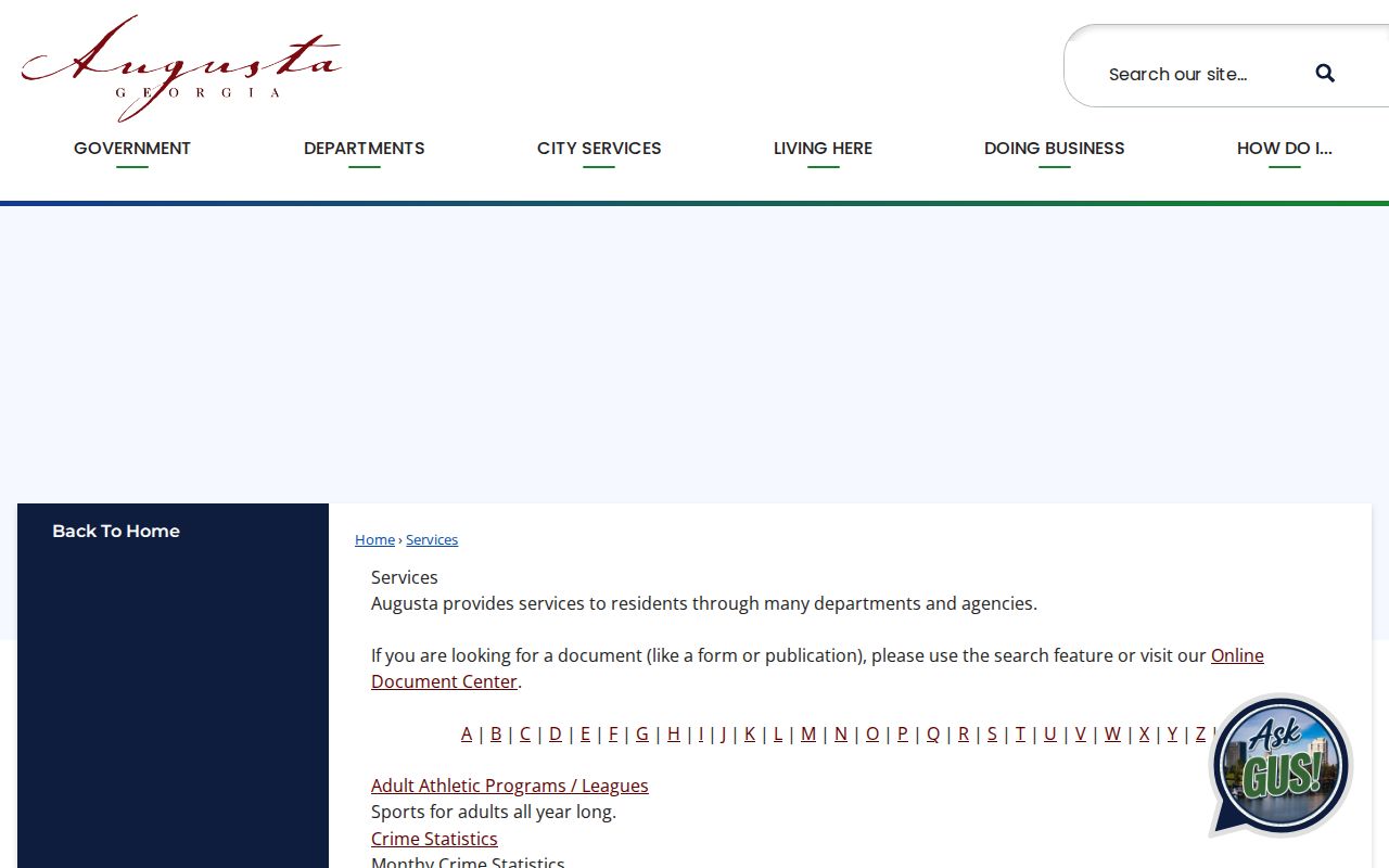
The service listing helps locate a public contact, while the parcel and postal tools remain the right sources for address geography.
Neighborhood names still need their own check. A familiar district label may cross a postal line, while one ZIP can contain several distinct local areas.
Compare Augusta Address Fields
Four address terms solve different problems. The ZIP code directs mail. The situs address is the physical place printed on an assessor card. The mailing address is where the tax notice goes and may belong to an owner elsewhere. The legal description identifies land through a subdivision, block, lot, unit, or metes-and-bounds wording.
| Field | What It Describes | Best Check |
|---|---|---|
| ZIP | Postal delivery area | USPS lookup |
| Situs | Physical parcel location | Augusta Maps property card |
| Mailing | Tax correspondence destination | Assessor card, with caution |
| Legal description | Land identity across transfers | Deed, plat, and parcel record |
A parcel number is usually the stable bridge between the map and tax record. Carry that number and the legal description when street spelling or numbering shifts. Postal, tax, and deed fields can all be correct while describing different aspects of the same Augusta property.
Write down the source beside each field. A USPS result should carry the retrieval date and standardized address. An Augusta Maps entry should preserve the parcel number, situs, owner name as indexed, and any separate tax mailing address. A deed reference should keep the book and page or instrument number. That small record trail makes it possible to explain why two sources disagree without choosing one by instinct.
Successive maps and directories may show an older form of the same place. No official source reviewed for Augusta identified one citywide street-renumbering year, so apparent changes should be tested against directory editions, plats, and Sanborn index sheets. The legal description can bridge those shifts when the street line fails. A ZIP code directory narrows the search area, while the parcel and deed identifiers keep the property stable across time.
Augusta ZIPs Versus City Limits
An Augusta postal label can extend beyond the legal city, and a Richmond County address can fall inside Hephzibah or Blythe. The west edge approaches Columbia County, while North Augusta belongs to Aiken County, South Carolina. Fort Eisenhower and Augusta University add federal and institutional address rules. A ZIP code directory cannot settle any of those jurisdiction questions by itself.
Use ZIP Codes to understand mail, Municipal Boundaries and Richmond County Line to choose government, and parcels to identify land. Old City Limits can help explain why a modern Augusta mailing address is missing from older municipal material. Historic Districts and census layers add context, not resident identity.
Boundary check. Never infer Augusta jurisdiction from a ZIP alone. Verify the USPS address, parcel county, and municipal line before choosing a records office.